Tracking the historic voyage of «Antarctic»

Centenary expedition to Weddel Sea in Antarctica
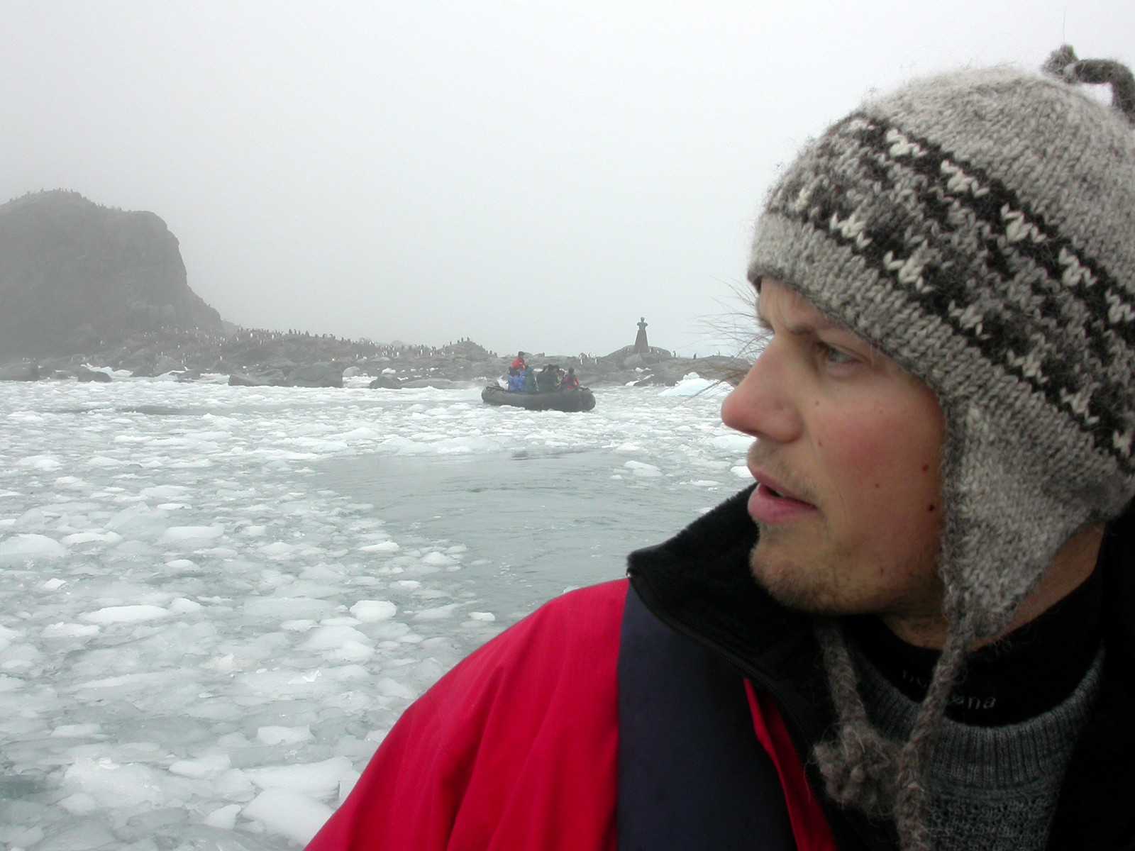
Photo documentary from my Antarctica trip back in 2003. The trip was a part of the ANTARCTIC QUEST 1903–2003 Expedition.
The ANTARCTIC QUEST 1903–2003 EXPEDITION was initiated to draw attention to the Norwegian contribution to the Swedish Otto Nordenskjöld expedition 1901–03. In particular the work of the Antarctic pioneer Captain C A Larsen, his crew and their relation to the Swedish scientists aboard the expedition ship «Antarctic».
As previous leader of two «Jason» expeditions to the west side of the Weddell Sea in 1892–94, Captain C A Larsen was able to give Nordenskjöld first hand information about the area to be explored. The Nordenskjöld expedition had an ill-fated end as «Antarctic» on return to bring home the wintering party at Snow Hill Island, was crushed in pack ice and sunk in the Weddell Sea. Shackleton’s ship «Endurance» had the same ill-fate 12 years later. Scientific results from the Nordenskjöld expedition with numerous publications, made this expedition one of the most important in «The Heroic Age» of international Antarctic exploration. A period that started with Johan Henrik Bull’s expedition to the Ross Sea 1894–95 aboard «Antarctic» and ended with Ernest Shackleon’s death at Grytviken, South Georgia in 1922 aboard his vessel «Quest».

Illustration by Kim Baumann Larsen based on the map from the book Antractica by J G Anderssons from 1944
Later he captained the ship Antarctic, as part of the Swedish Antarctic Expedition of 1901–04. During this mission some of his crew wintered for 10 months at Snow Hill Island and after his ship was crushed by ice and sank, he and his crew spent the winter of 1903 on Paulet Island, surviving on penguins and seals before being rescued by the Argentine corvette Uruguay.
The expedition ship Antarctic
In October 1903 the swedish Otto Nordenskjöld left for his expedition to Antarctica aboard Antarctic with Captain C A Larsen as master and «guide» — to the same part of West-Antarctica discovered by Larsen almost 10 years earlier. Nordenskjöld-expedition had a dramatic ill-fate, but their scientific results with numerous publications, made it one of the most successful in «the heroic age» of Antarctic exploration.
Dramatic 10 month in Weddel Sea in 1903.
During Nordenskjöld´s wintering with his men at Snow Hill, Antarctic with scientists and crew carried out their program with voyages to Ushuaia, Falkland Islands, South Georgia and back to Ushuaia, bunke-ring coal before return to Weddel Sea. Ice conditions in Antactic summer 1902–03 were extreme and in attempt to meet Otto Nordenskjöld and wintering party at Snow Hill, Antarctic was crushed in icepack and shipwrecked on 12 February 1903 at 1245 pm.
It was unique that all men survived this disaster and were able to bring limited equipment onto the icepack. After 18 days on the ice they reached the uninhabited Paulet Island, built a stone hut and survived in isy blizzards during the Antarctic winter, slaughtering pingvins and seals for heating and food.
When the Argentine corvette Uruguay came to resque the wintering party at Snow Hill, Captain C A Larsen and 5 of his crew had managed to row 180 km in icecovered waters from Paulet Island via Hope Bay and reached Seymour Island 8 November (the day of wonder), the same day Uruguay was about to leave, due to severe ice conditions.
Behind on Paulet Island was the grave of Ole Kristian Wennersgaard,a 22 yearNorwegian who died of heart disease in middle of the winter.
In 1916 Ernest Shackleton and his men stranded on Elefant Island — east of Paulet Island — after the shipwreck of Endurance in the Weddel Sea. When Shackleton and 5 of his men sailed with James Coird for South Georgia and the rescue, his men on the island were living in the same situation of uncertainty and coldness, as Larsen´s men at Paulet Island.

Our 2003 route of Antarctic Quest
— tracking last voyage of «Antarctic».
04.02 — Arrival Buenos Aires, Argentina
05.02 — Arrival Ushuaia, Argentina, boarding «Grigoriy Mikheev»
06.02— Through Drakes Strait
07.02 — Drage Strait, Deception Island
08.02 — Gerlache Channel
09.02 — Hope Bay stone hut
10.02 — Seymour Island (window to the past)
11.02 — Wintering hut at Snow Hill
12.02 — Weddel Sea at 1245 pm, Paulet Island with hut and grave
13.02 — Elephant Island, wintering island of «Endurance» crew 1915
14.02 — Through Drake Strait
15.02 — Drake Strait, Puerto Haberton
16.02 — Arrival Ushuaia
17.02 — Buenos Aires — visit «Uruguay»

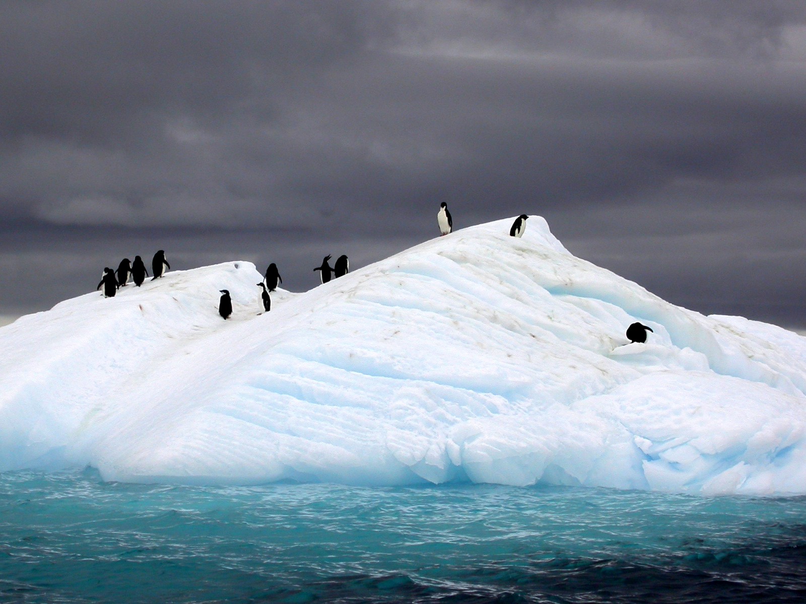
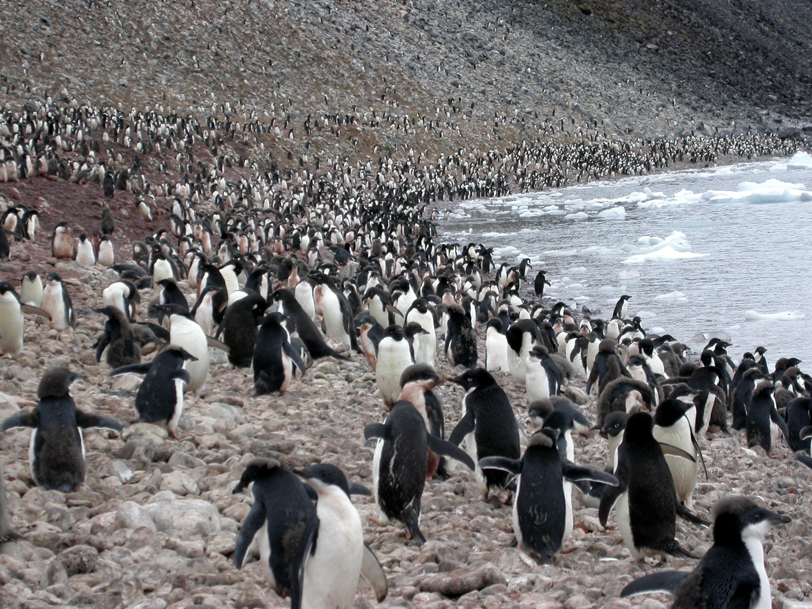
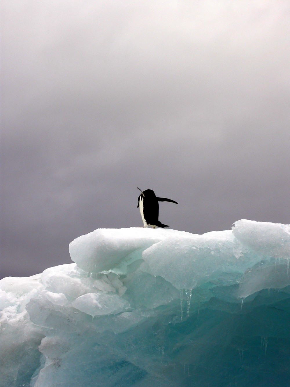
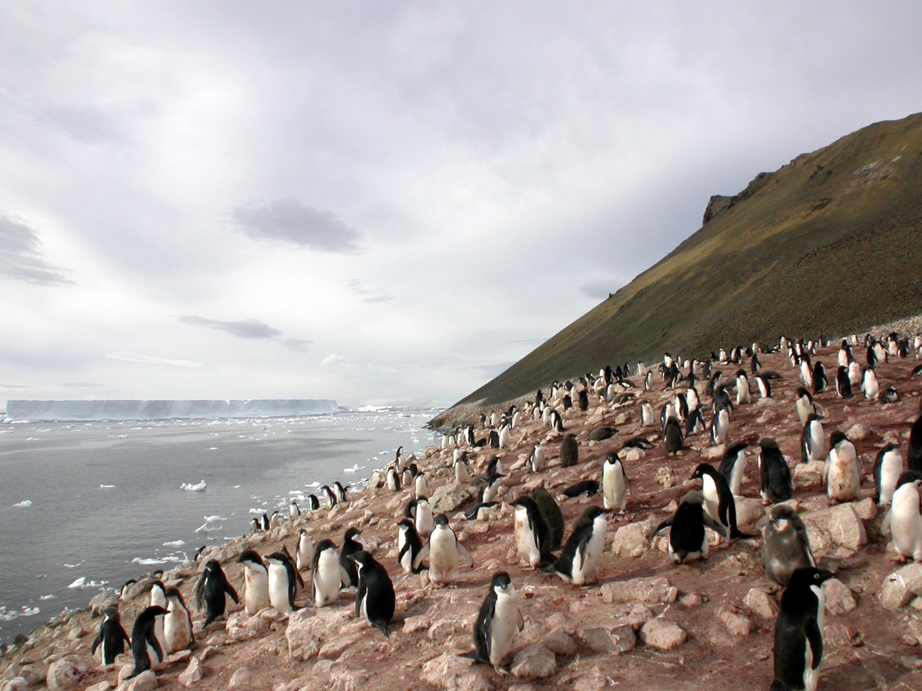
The Adélie penguin (Pygoscelis adeliae) is a species of penguin common along the entire Antarctic coast, which is their only residence. (Photo: Teodor Bjerrang)
Some selected photos from the trip


The start of the journey
Scott Polar Research Institute
University of Cambridge, May 2002
Meeting Mr Robert (Bob) Headland (Senior associate of the Scott Polar Research Institute at the University of Cambridge) and visiting Shackleton Memorial Library for reashering the Otto Nordenskjöld and Captain C A Larsen story of 1903.
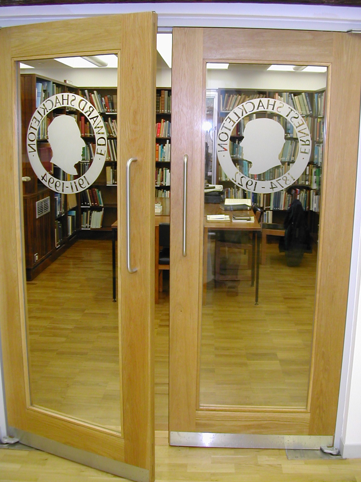
Shackleton Memorial Library

Preparation back in Oslo, Norway
25 January 2003
Packing list
Clothes
Norrøna, Folgefonna Jacket
Norrøna Storm Jacket and Pants
Gloves, Hestra Alpine Gore-Tex, Polartec — Power Dry
Head, Haddock
Boots, Kamik Icebreaker
Sunglasses, CÉBÉ 2000 CAT CE 4
Storage
Norrøna Para Ranger pack 120 l
Peli Case, UK 822
Camera
Nikon F5, Nikon ED AF Nikkor 80–200mm 1:2,8D, Tamron AF 19–35mm 1:3,5–4,5, Tamron AF CD 28–200 1:38–5,6
Nikon 4500, Nikon FC-E8, Manfrotto Gruppo
Sony DSR-PD150P, Sony Wide Conversion Lens X0.7, Sony ECM-NV1
Canon MV20i


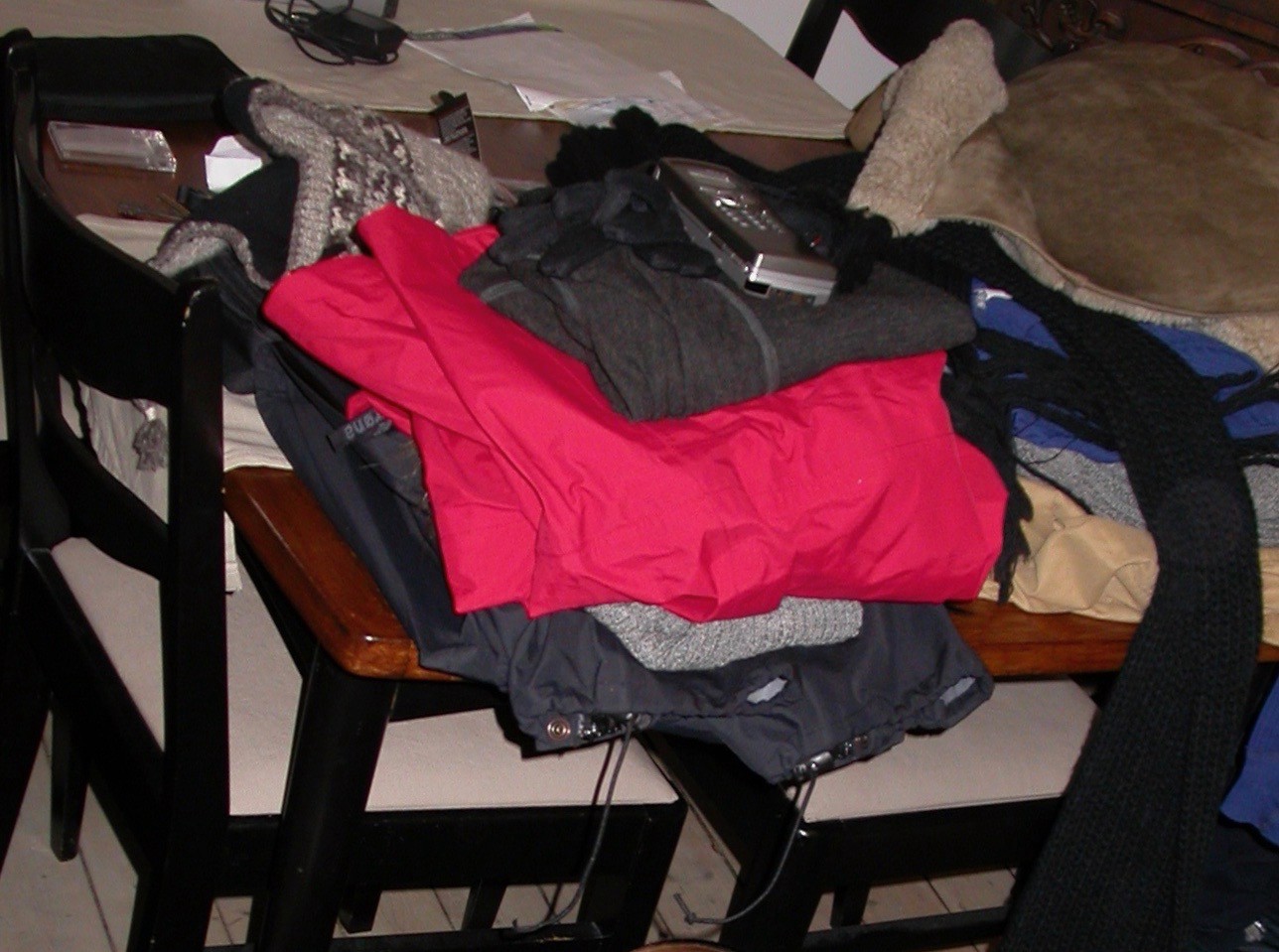
Packing the equipment back home at my apartment in Oslo.
Ushuaia
5 February 2003 — Position 54°45’S / 68°30'W — 10°C
Arrival Ushuaia / Tierra del Fuego, Argentina, boarding «Grigoriy Mikheev»
Ushuaia is the capital of Tierra del Fuego, Antártida e Islas del Atlántico Sur Province, Argentina. It is commonly regarded as the southernmost city in the world.

Ushuaia harbor — Crossing The Drake Passage the next two days (5 February 2003)
Deception Island / Whalers Bay
8 February 2003 — Position 62°52’S / 60°05'W — Air 4°C, Water 2°C, Pressure 997 mb, Light rain, misty.
Deception Island is an island in the South Shetland Islands archipelago, with one of the safest harbours in Antarctica. This island is the caldera of an active volcano, which seriously damaged local scientific stations in 1967 and 1969. The island previously held a whaling station; it is now a tourist destination and scientific outpost, with Argentine and Spanish research bases. While various countries have asserted sovereignty, it is still administered under the Antarctic Treaty System.


Astrolabe Island
8 February 2003 — Position 63°17’S / 58°40'W
Astrolabe Island, located at 63°17′S 58°40′W, is an island 5 km (3 mi) long, lying in the Bransfield Strait 23 km (14 mi) northwest of Cape Ducorps, Trinity Peninsula in Antarctica. It was discovered by the French expedition, 1837–40, under Captain Jules Dumont d’Urville, and named by him for his chief expedition ship, the Astrolabe.


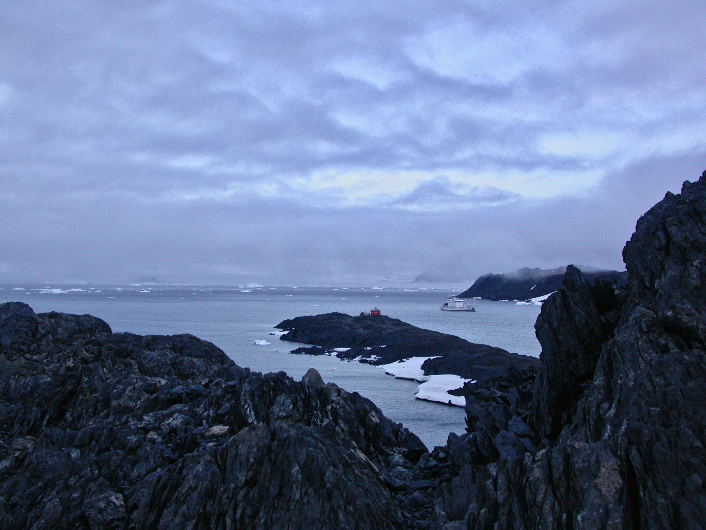
Grigoriy Mikheev
Grigoriy Mikheev — A modern research vessel belongs to the Hydrographic Institute of Saint Ptersburg (Built in 1990 in Finland) and is reinforced for ice and sailing in the frozen conditions of the Polar Regions.
Esperanza Base / Hope Bay
9 February 2003 — Position 63°23’S / 57°00'W — Air 0°C, Water 1°C, Wind 7 Beaufort E, near gale, Pressure 1005 mb
Esperanza base (Spanish: Base Esperanza, “Hope Base”) is a permanent, all year-round Argentine research station in Hope Bay, Trinity Peninsula (Graham Land, Antarctic Peninsula). It is one of only two civilian settlements on Antarctica (the other being the Chilean Villa Las Estrellas). The Base’s motto is “Permanencia, un acto de sacrificio” (“Permanence, an act of sacrifice”).

Esperanza base


Hope Bay was discovered on January 15, 1902 by the Swedish Antarctic Expedition (SwedAE) under Otto Nordenskiöld, who named it in commemoration of the winter spent there by J. Gunnar Andersson, S.A. Duse, and Toralf Grunden of his expedition.
The ruins of a stone hut built in January 1903 by members of the Swedish expedition can still be seen; it has been designated a Historic Site or Monument (HSM 39), following a proposal by Argentina and the United Kingdom to the Antarctic Treaty Consultative Meeting.

Hope Bay Museum.
Brown Bluff
9 Februar 2003 — Position 63°32’S / 56°55'W
Brown Bluff is a basalt tuya located on the Tabarin Peninsula of northern Antarctica. It formed in the past 1 million years, which erupted subglacially within an englacial lake. The volcano’s original diameter is thought to have been about 12–15 kilometers, and probably formed by a single vent. Brown Bluff is subdivided into four stages: pillow volcano, tuff cone, slope failure, and hyaloclastite delta and into five structural units. The volcano is named “Brown Bluff” because of its steep slopes and its brown-to-black hyaloclastite.


Seymour Island / Penguin Point
10 February 2003 — Position 64°19’S / 56°43'W — Air -2°C, Water 1°C, Wind light breeze NE, Pressure 1016 mb, sunny
Seymour Island is an island in the chain of 16 major islands around the tip of the Graham Land on the Antarctic Peninsula. Graham Land is the closest part of Antarctica to South America. It lies within the section of the island chain that resides off the west side of the peninsula’s northernmost tip.

Cockburn Island
Cockburn Island is an oval island 2.7 kilometres (1.7 mi) long, consisting of a high plateau with steep slopes surmounted on the northwest side by a pyramidal peak 450 m (1,476 ft) high, lying in the north-east entrance to Admiralty Sound, south of the north-east end of the Antarctic Peninsula. It was discovered by a British expedition (1839-43) led by Captain James Clark Ross, who named it for Admiral Sir George Cockburn, then serving as First Naval Lord (commander-in-chief of the Royal Navy).
Geologically, the area makes up the Cockburn Island Formation, which was studied extensively in the late 1990s by H. A. Jonkers. Rocks found on the island are volcanic, and the island is characterized by its "precipitous cliffs". A "Pecten conglomerate" from the late Pliocene or early Pleistocene period has been identified on the island, situated on a wave-cut platform at 720–820 ft. The island is a rare volcano type called a tuya, or moberg, which was formed by a three-stage eruption sequence below an ice cap. The first stage was a subglacial hyaloclastic eruption under a thick ice cap, which shattered the lava into glass, ash and sand, which has since weathered to yellow palagonite layers. The second phase was a lava eruption into a meltwater glacial lake contained in the ice cap, which resulted in volcanic breccia and basalt pillow lava (boulders of this can be seen along the shore). The final phase was subaerial basalt lava flows on top of the previous volcanic deposits after the lake drained or boiled away.

Base Marambio
Base Marambio
Marambio Base (Spanish: Base Marambio) is a permanent, all year-round Argentine Antarctica base named after Vice-Commodore Gustavo Argentino Marambio, an Antarctic aviation pioneer. It is located in Marambio Island, Graham Land, Antarctic Peninsula, some 100 km (60 mi) from the coastal civilian village of Esperanza.
At the time of its construction it was the first airfield in Antarctica and is still one of the most frequently used ones due to its suitability for wheeled landing, for which it is called "Antarctica's Entrance Door" (Spanish: Puerta de Entrada a la Antártida). It is also Argentina's most important base in the continent.
As of 2014 Marambio is one of 13 research bases in Antarctica operated by Argentina. (Map)


Snow Hill Island
10 February 2003 — Position 64°28’S / 57°12'W
Snow Hill Island is an almost completely snowcapped island, 33 km (21 mi) long and 12 km (7.5 mi) wide, lying off the east coast of the Antarctic Peninsula. It is separated from James Ross Island to the north-east by Admiralty Sound. It is one of several islands around the peninsula known as Graham Land, which is closer to South America than any other part of the Antarctic continent.

Snow Hill Island


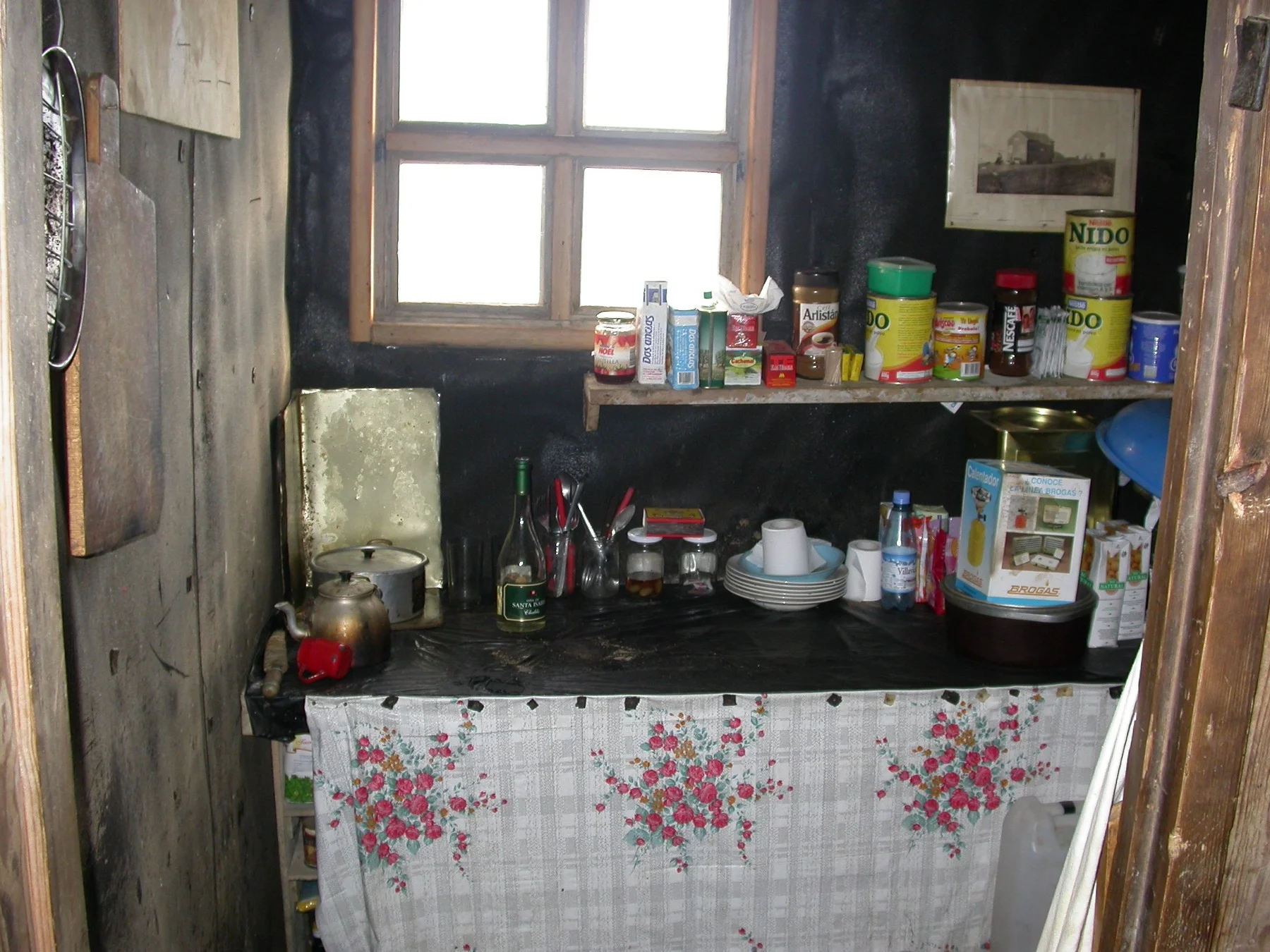


Snow Hill Hut (Swedish Hut, Nordenskiöld House)
Wooden hut on Snow Hill Island built in February 1902 by the main party of the Swedish South Polar Expedition led by Otto Nordenskjöld.
64º21´50´´S, 56º59´31´´W
Inside the Hut. Photo by Teodor Bjerrang


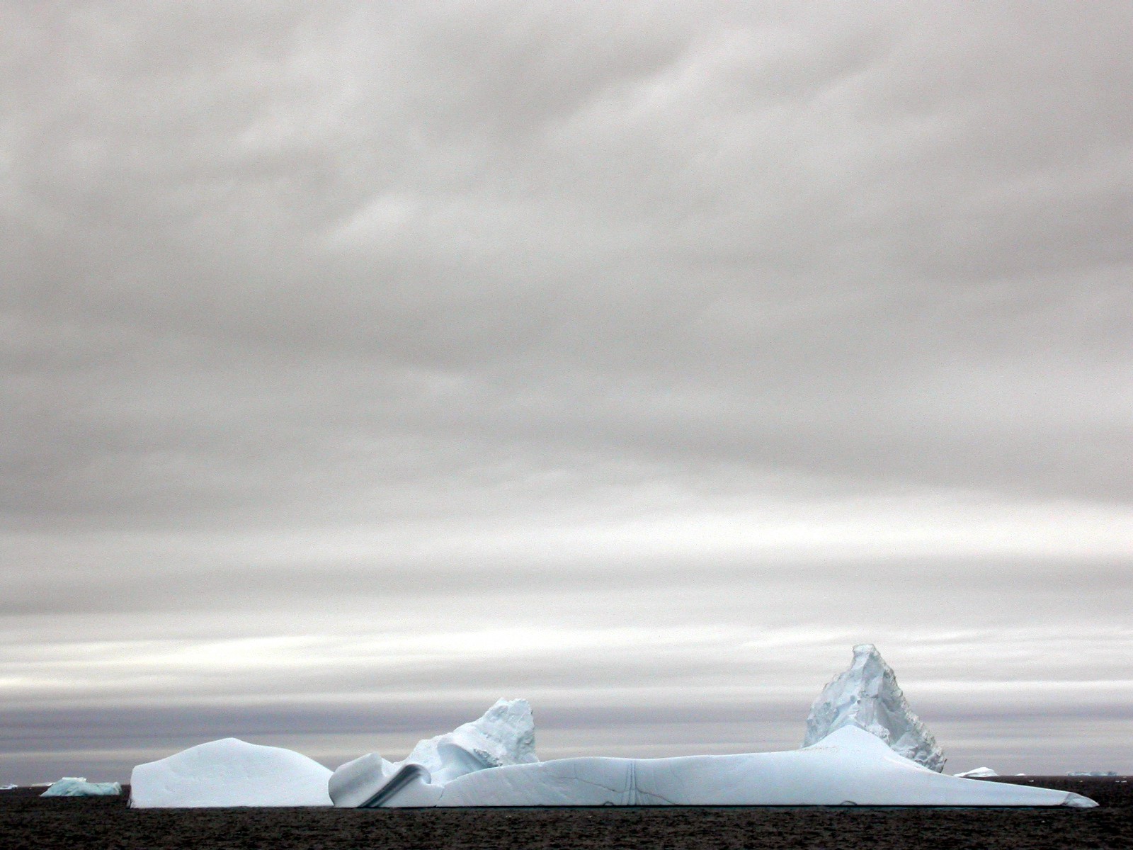
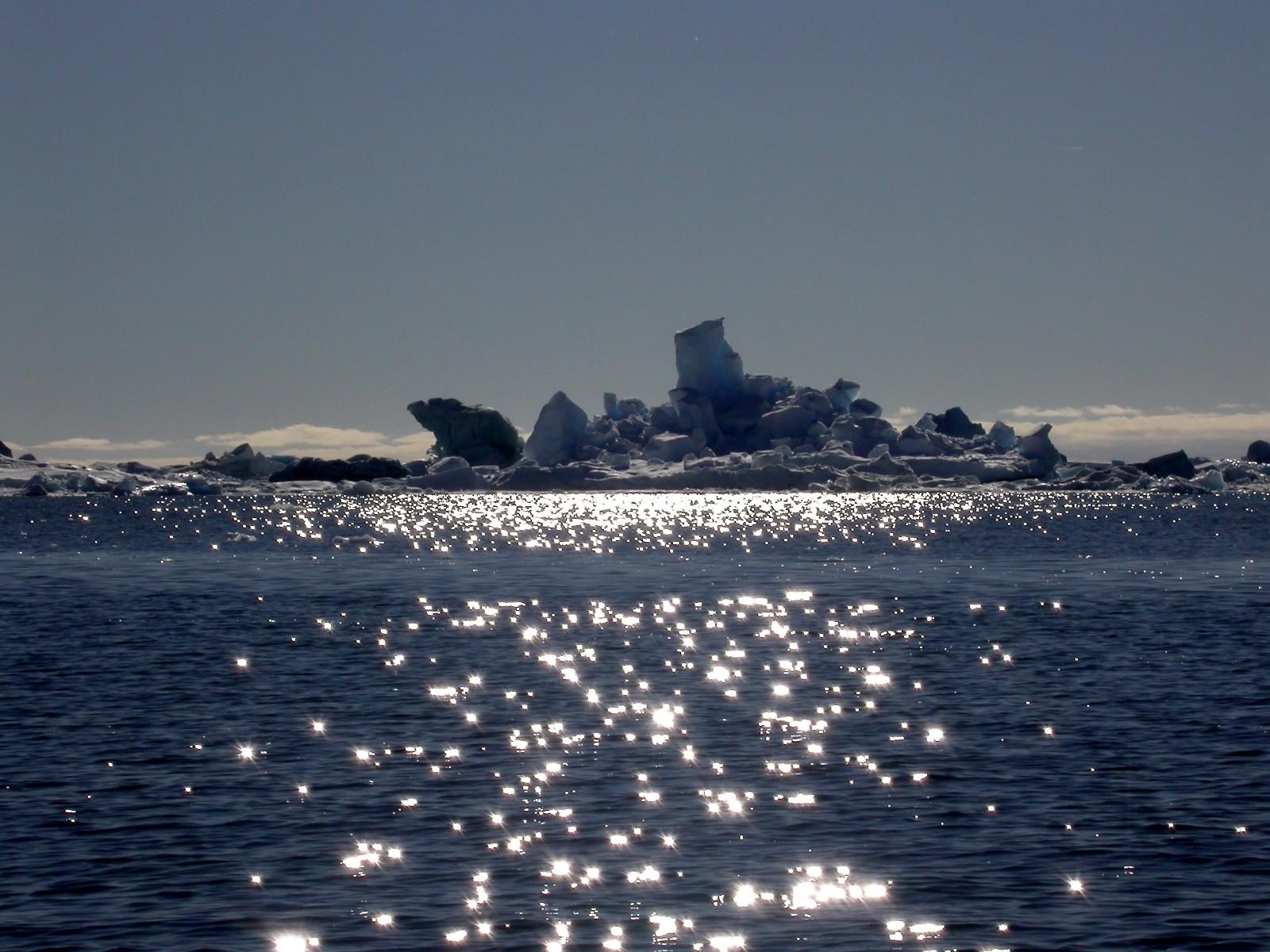
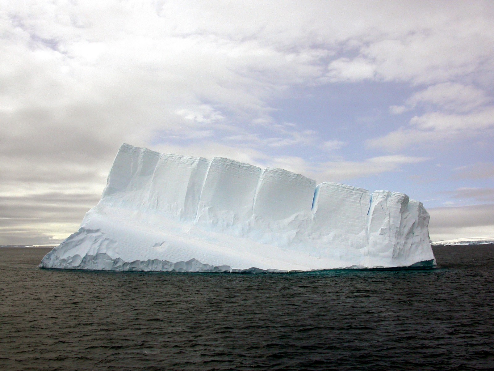
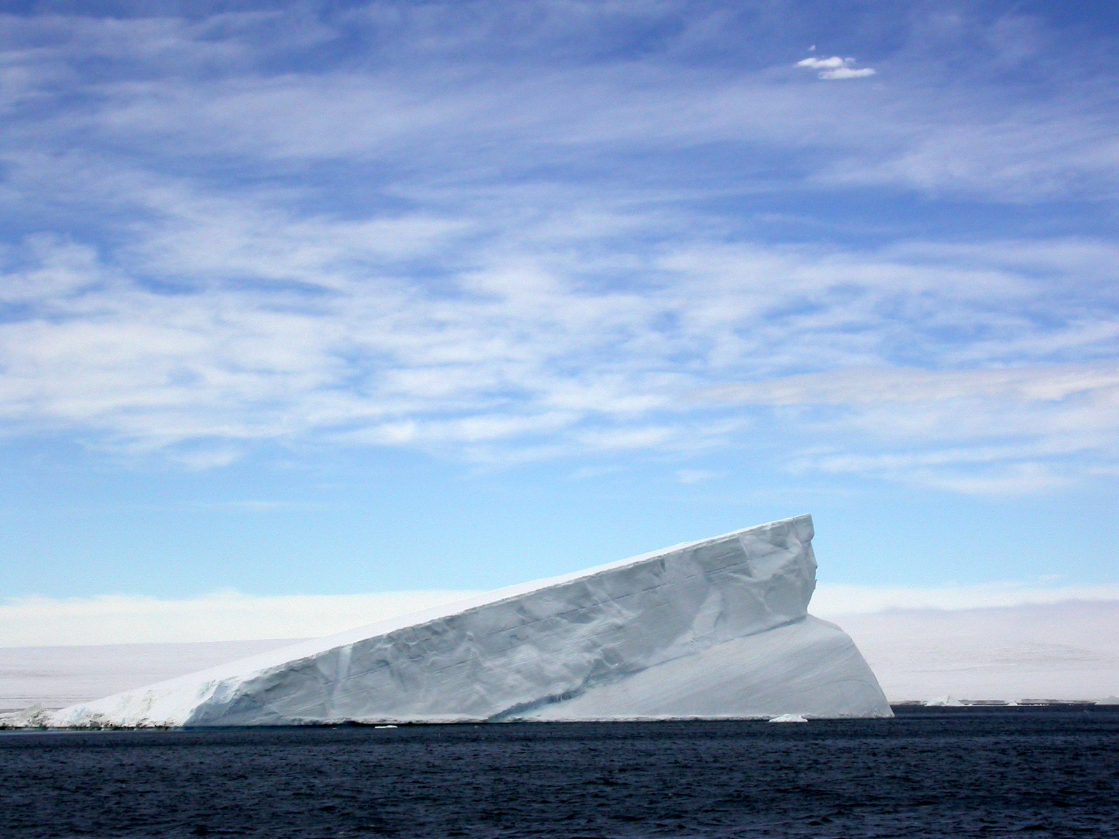
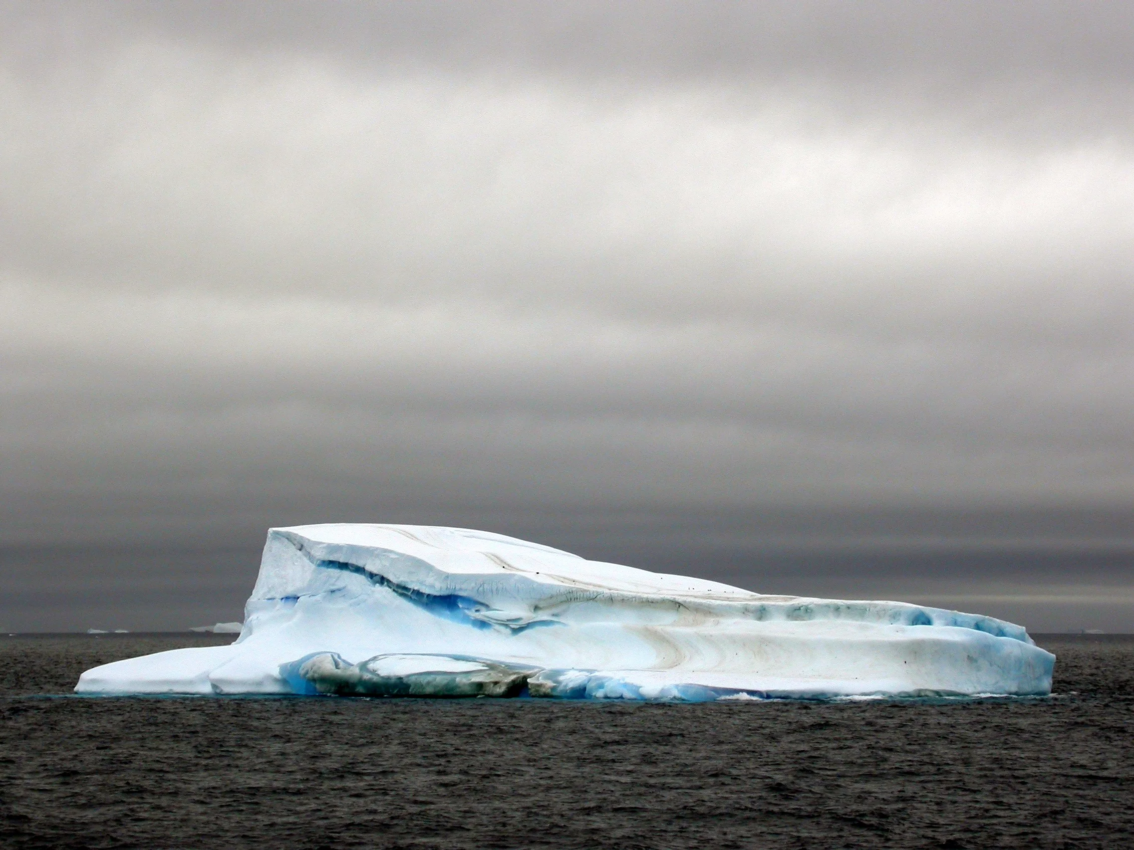
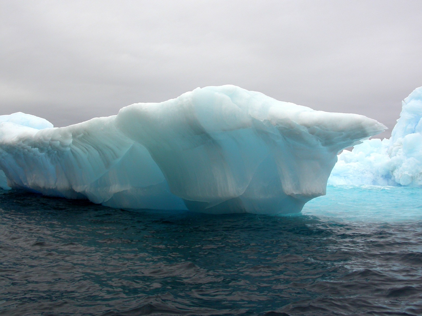
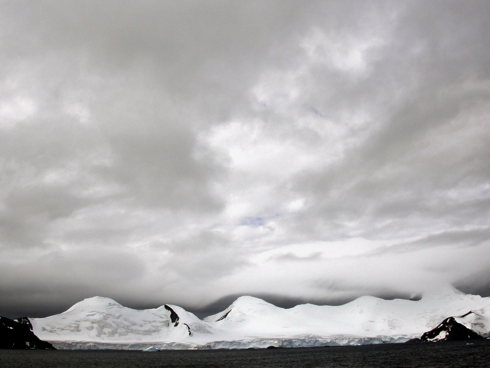
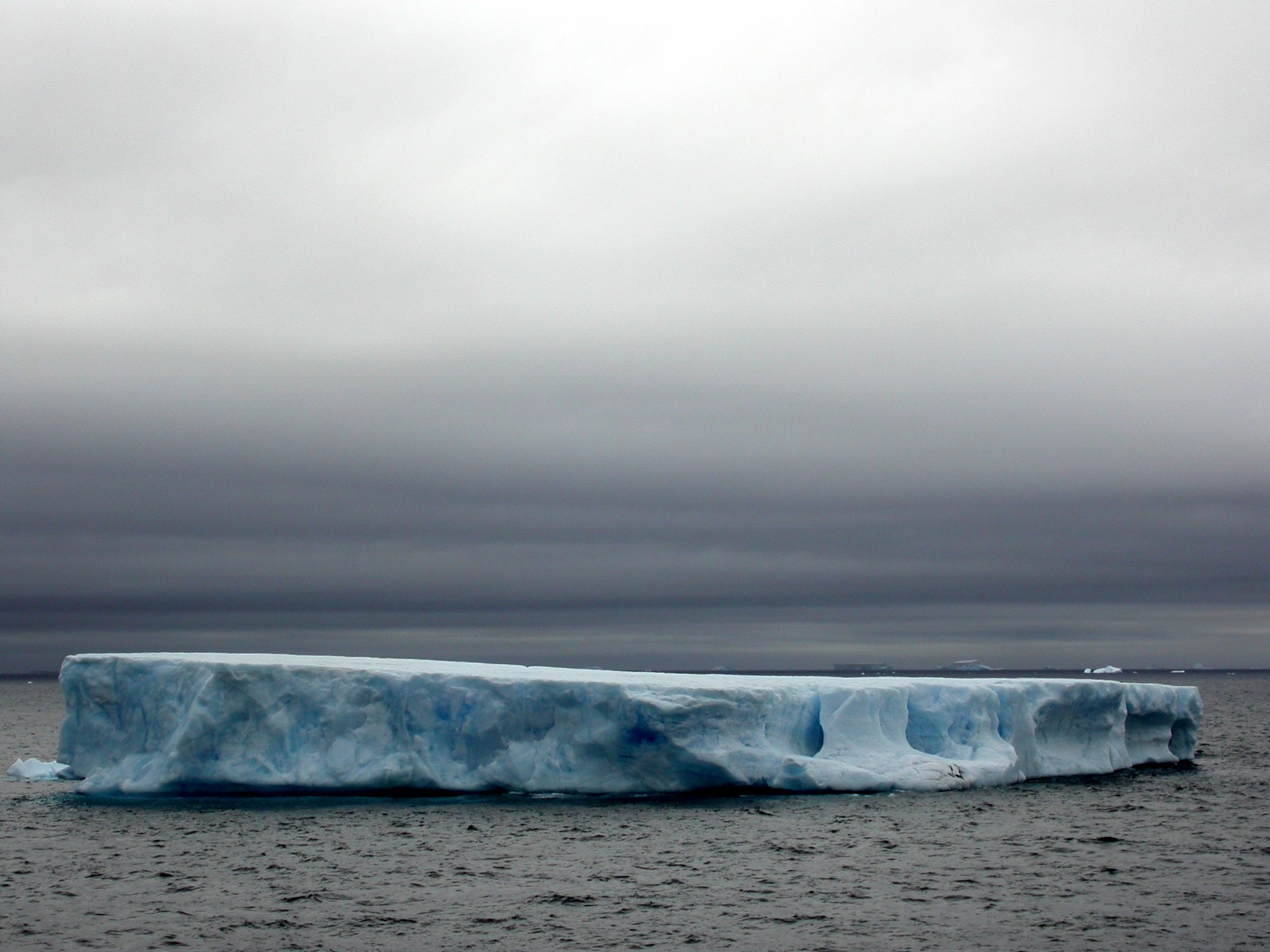
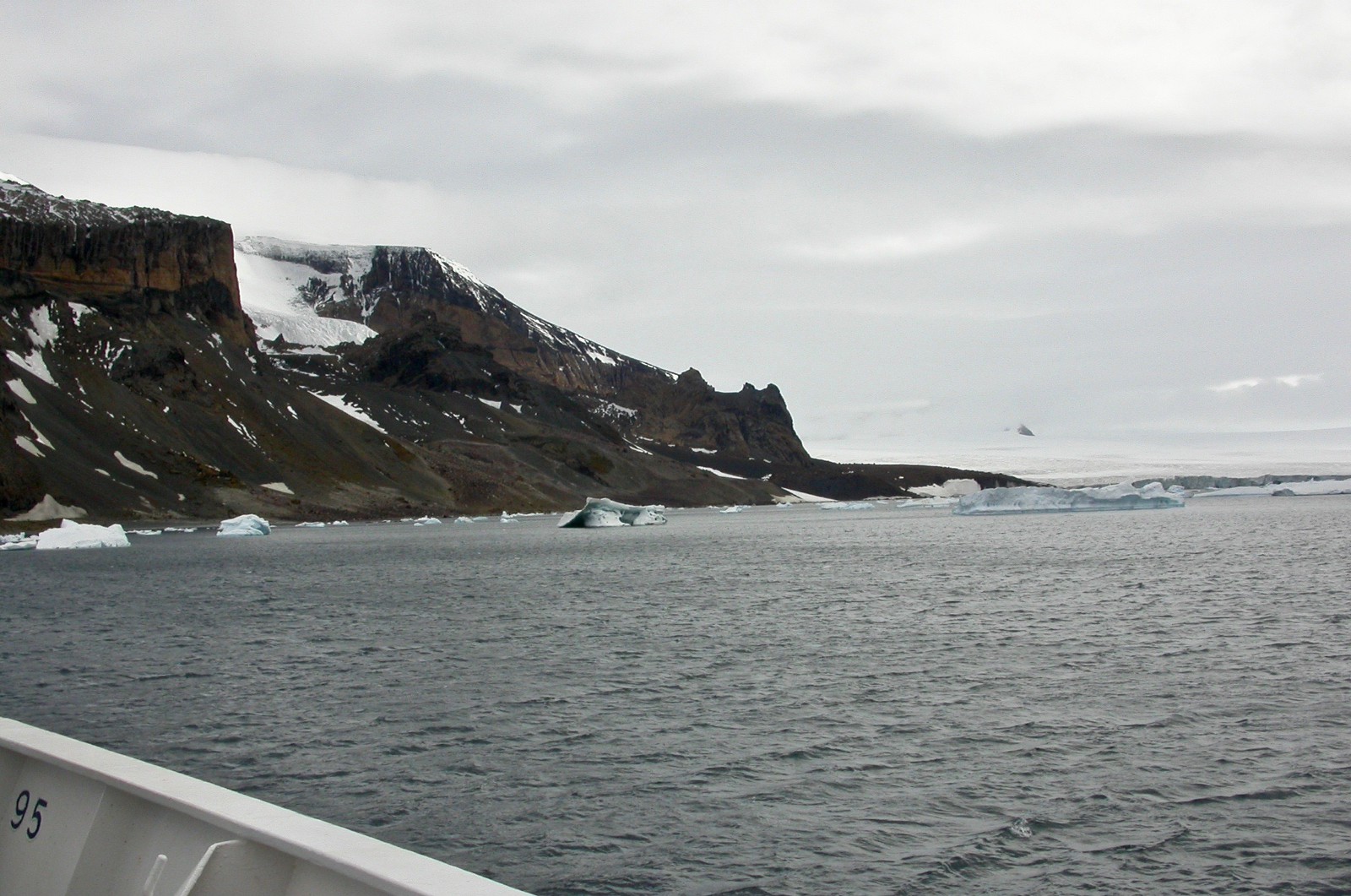
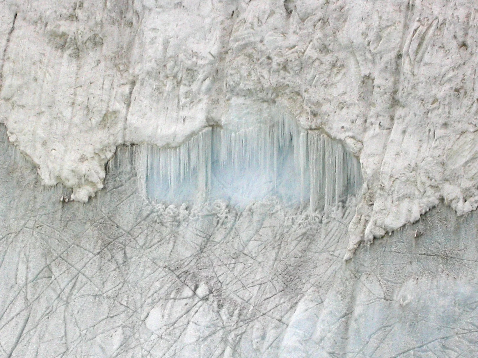
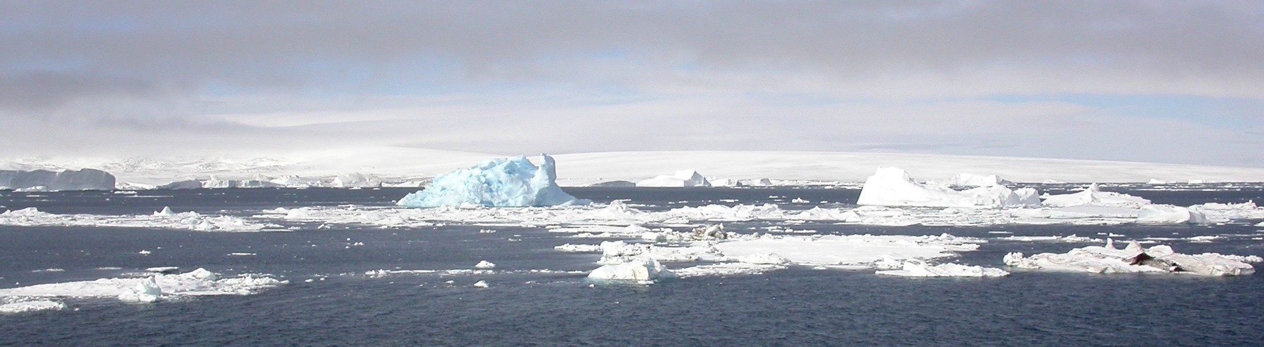
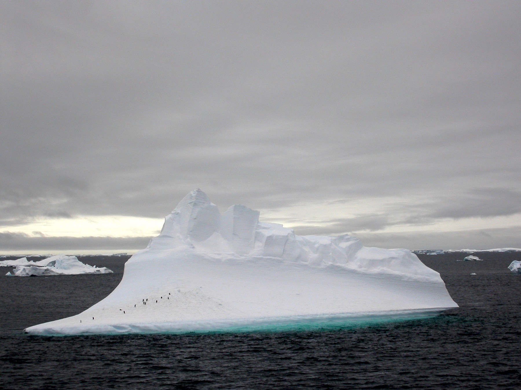
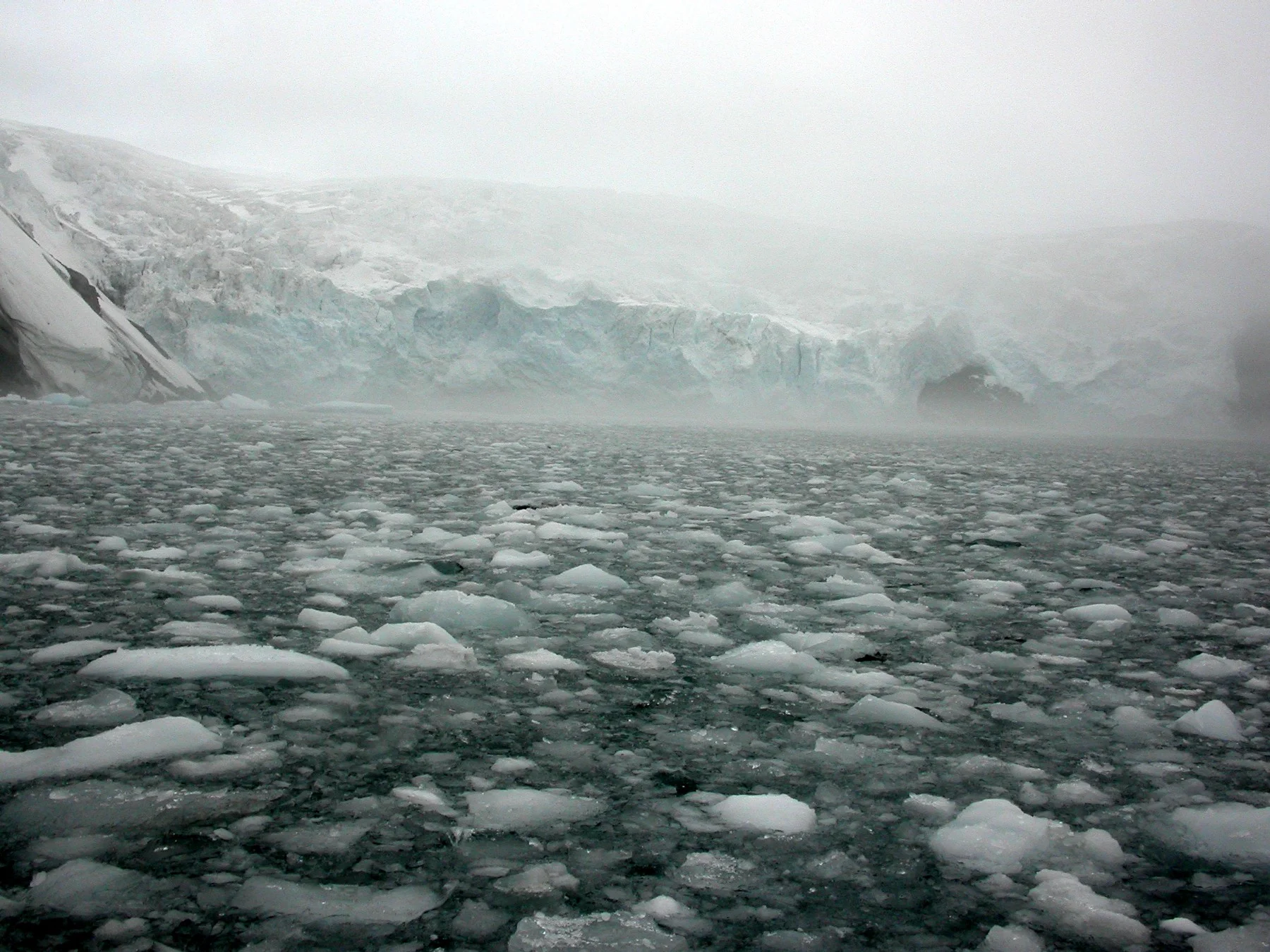
More ice on the way to the Weddell Sea
11 February 2003 — Position 64°23’S / 57°15'W (Admiralty Sound), — Position63°48’S / 57°17'W (Devil Island) — Air 2°C, Water 1°C, Wind none, Pressure 1003 mb, mostly sunny with hight clouds
“The Weddell Sea is, according to the testimony of all who have sailed through its berg-filled waters, the most treacherous and dismal region on earth. The Ross Sea is relatively peaceful, predictable, and safe.”
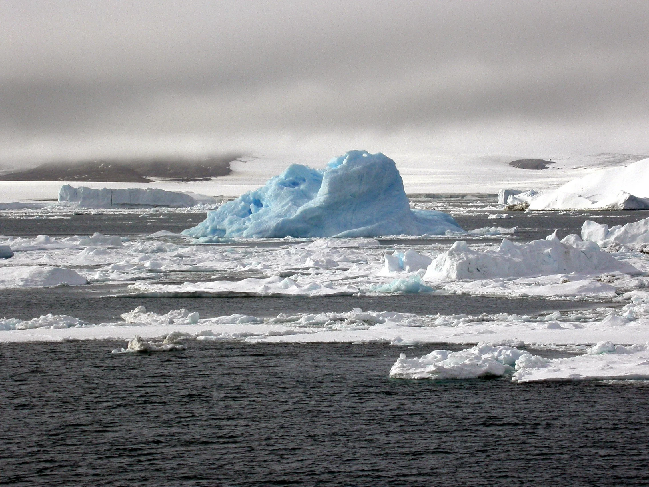

Some Ice facts: The Antarctic ice sheet is one of the two polar ice caps of the Earth. It covers about 98% of the Antarctic continent and is the largest single mass of ice on Earth. It covers an area of almost 14 million square kilometres (5.4 million square miles) and contains 26.5 million cubic kilometres (6,400,000 cubic miles) of ice. Approximately 61 percent of all fresh water on the Earth is held in the Antarctic ice sheet, an amount equivalent to about 58 m of sea-level rise. In East Antarctica, the ice sheet rests on a major land mass, while in West Antarctica the bed can extend to more than 2,500 m below sea level. (Wikipedia)


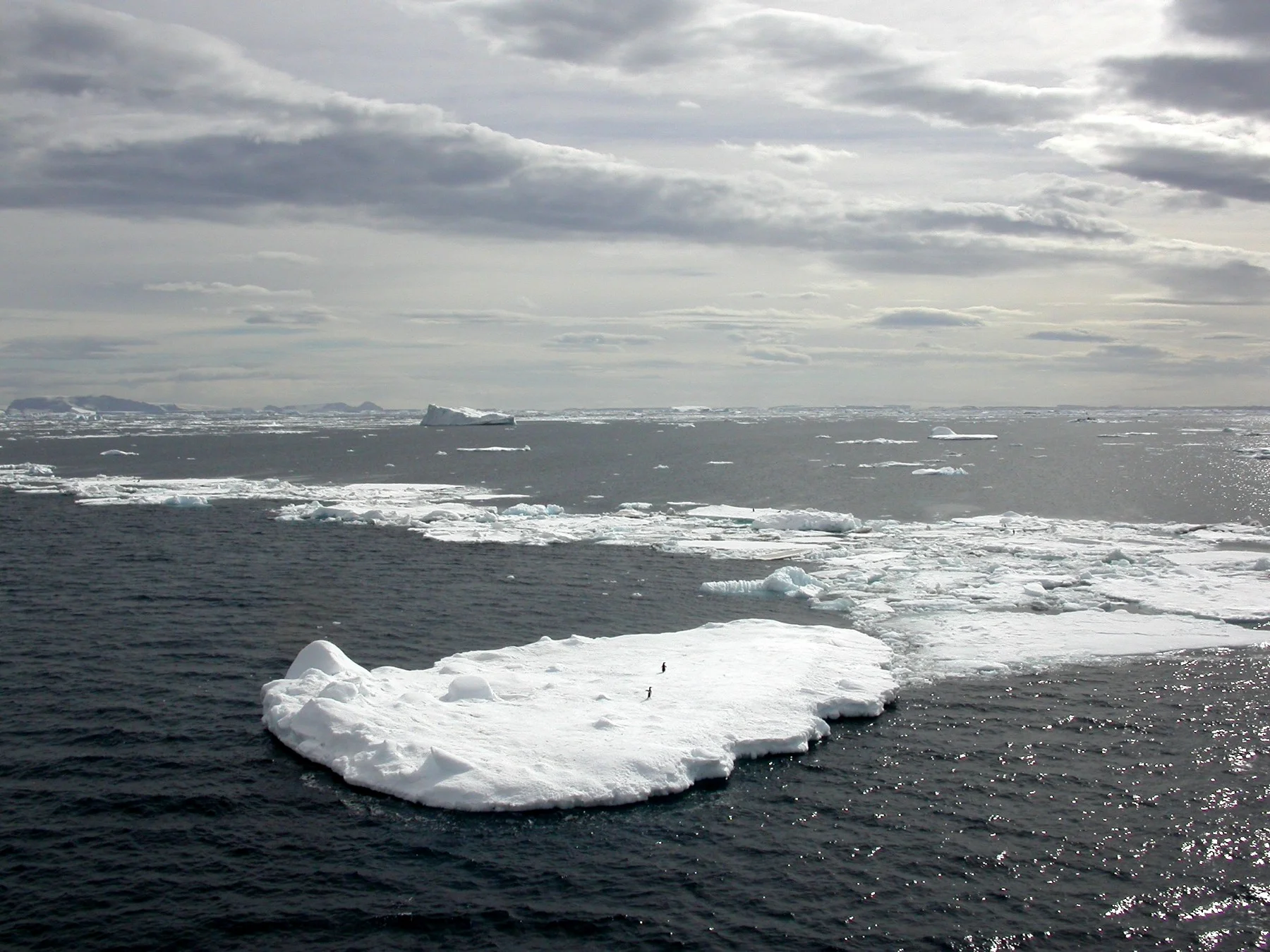

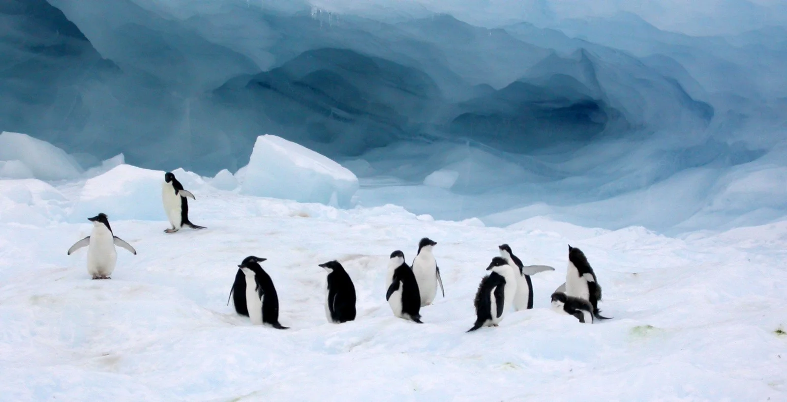
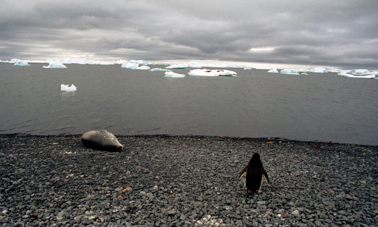
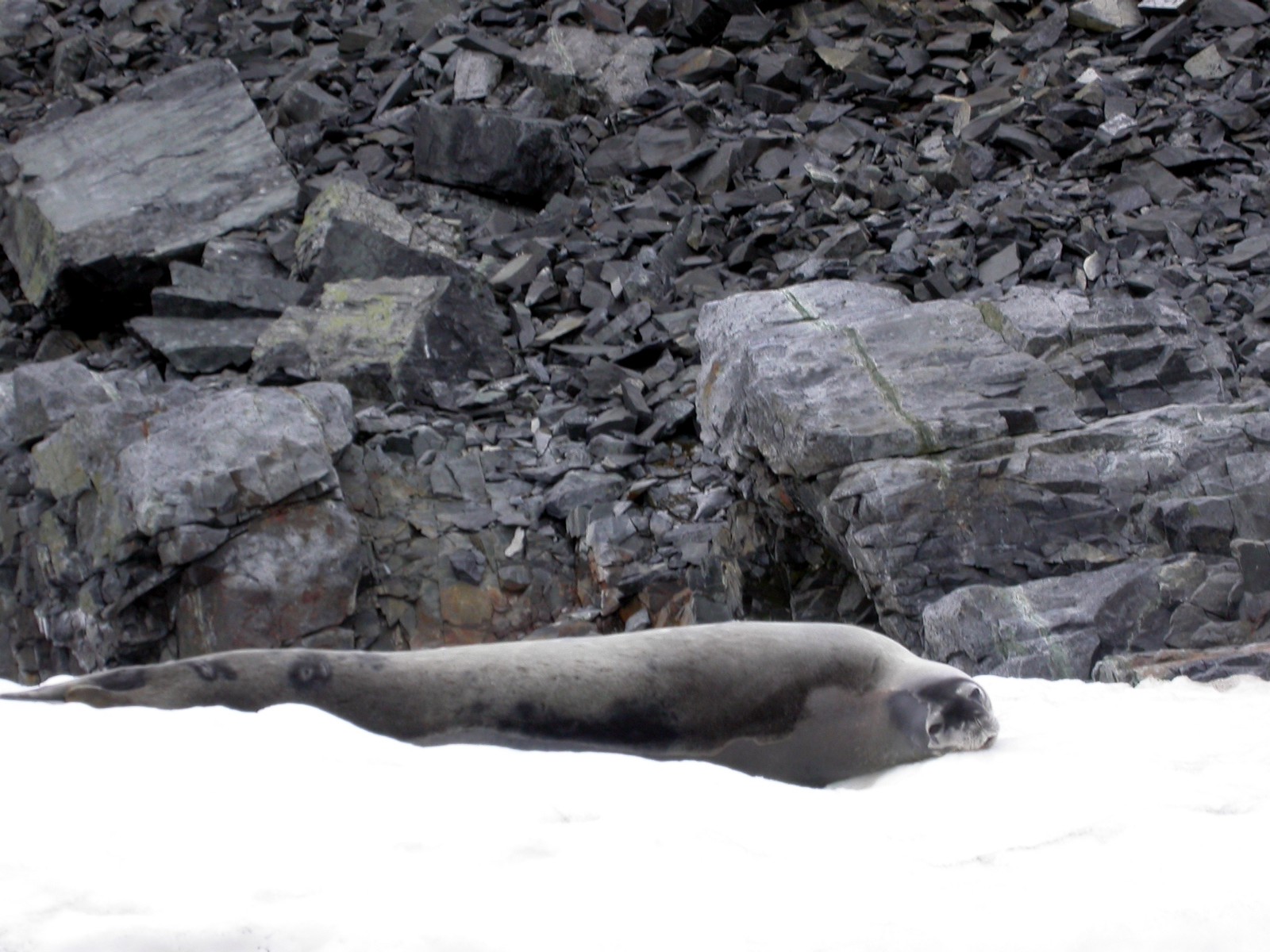
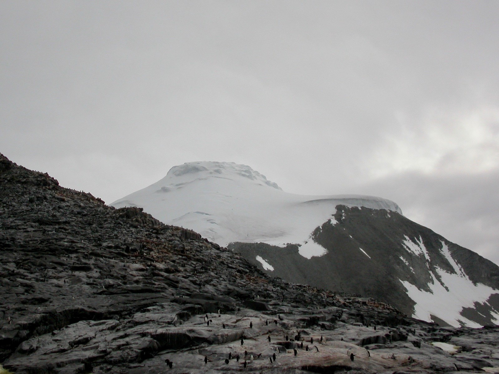
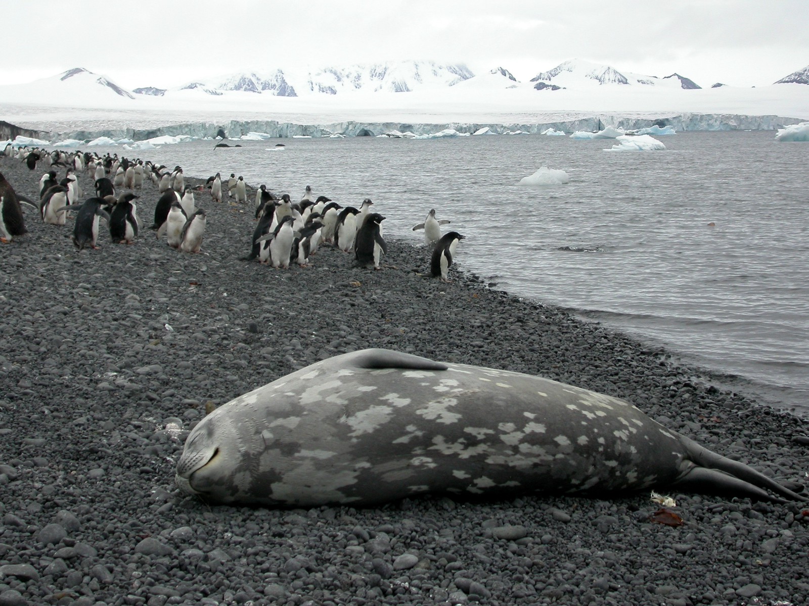
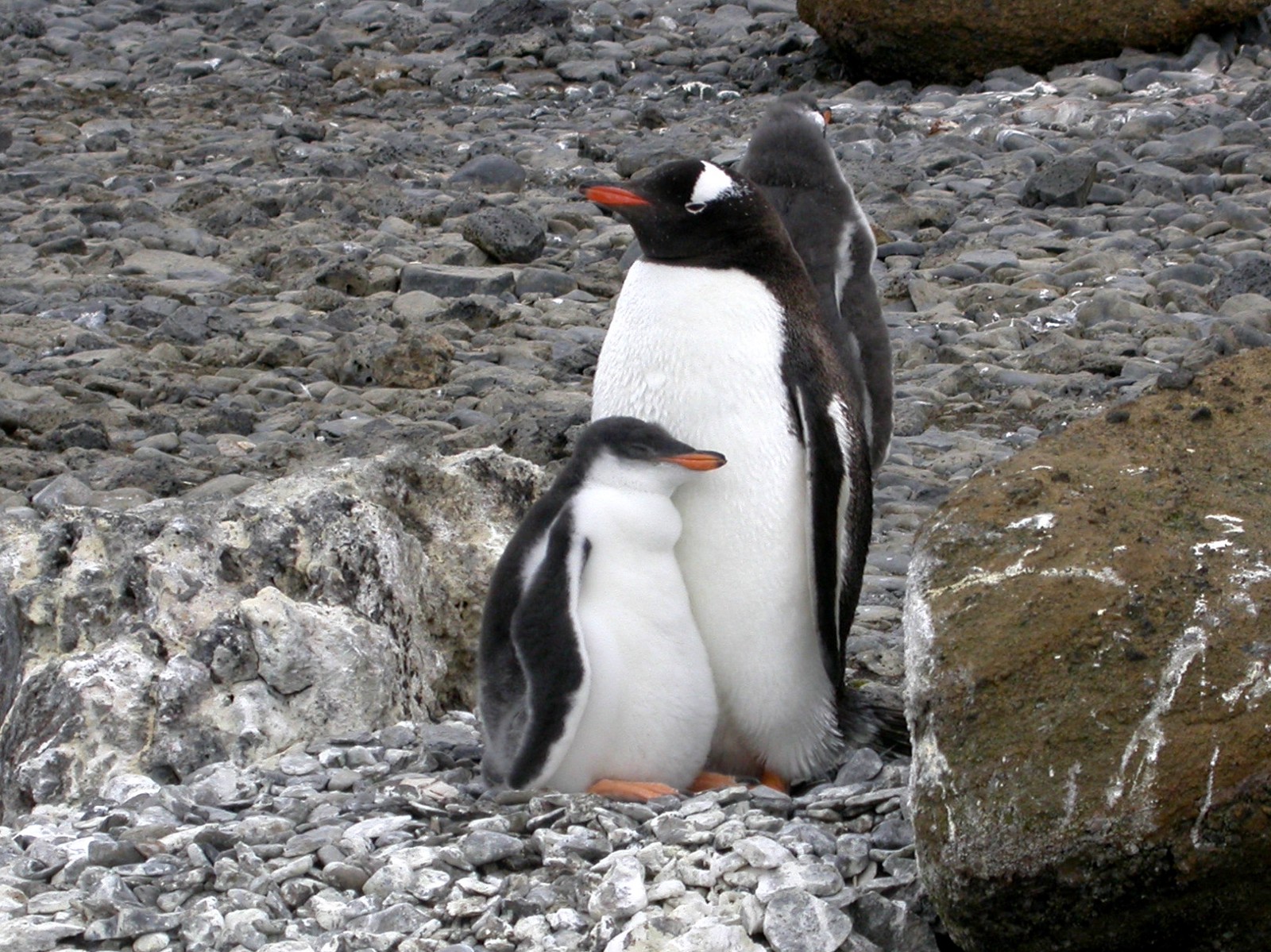
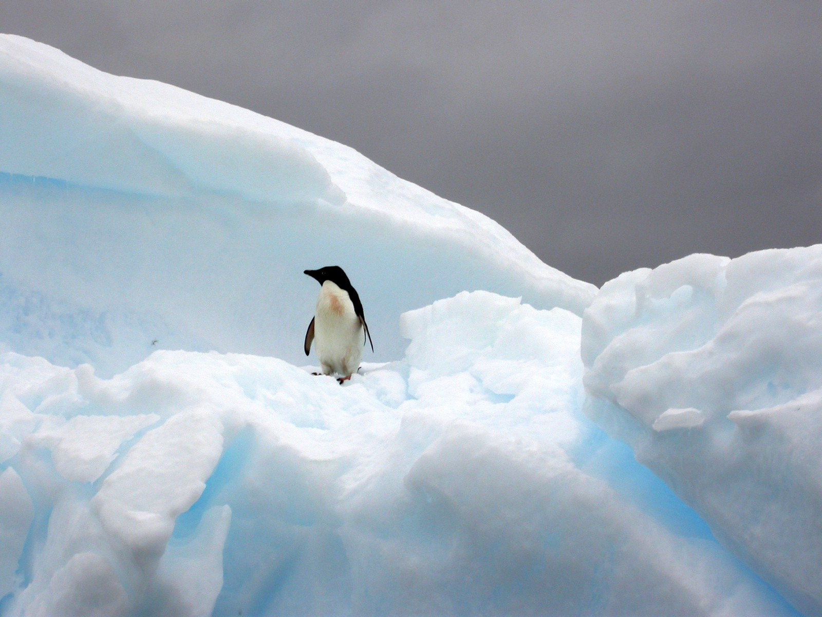
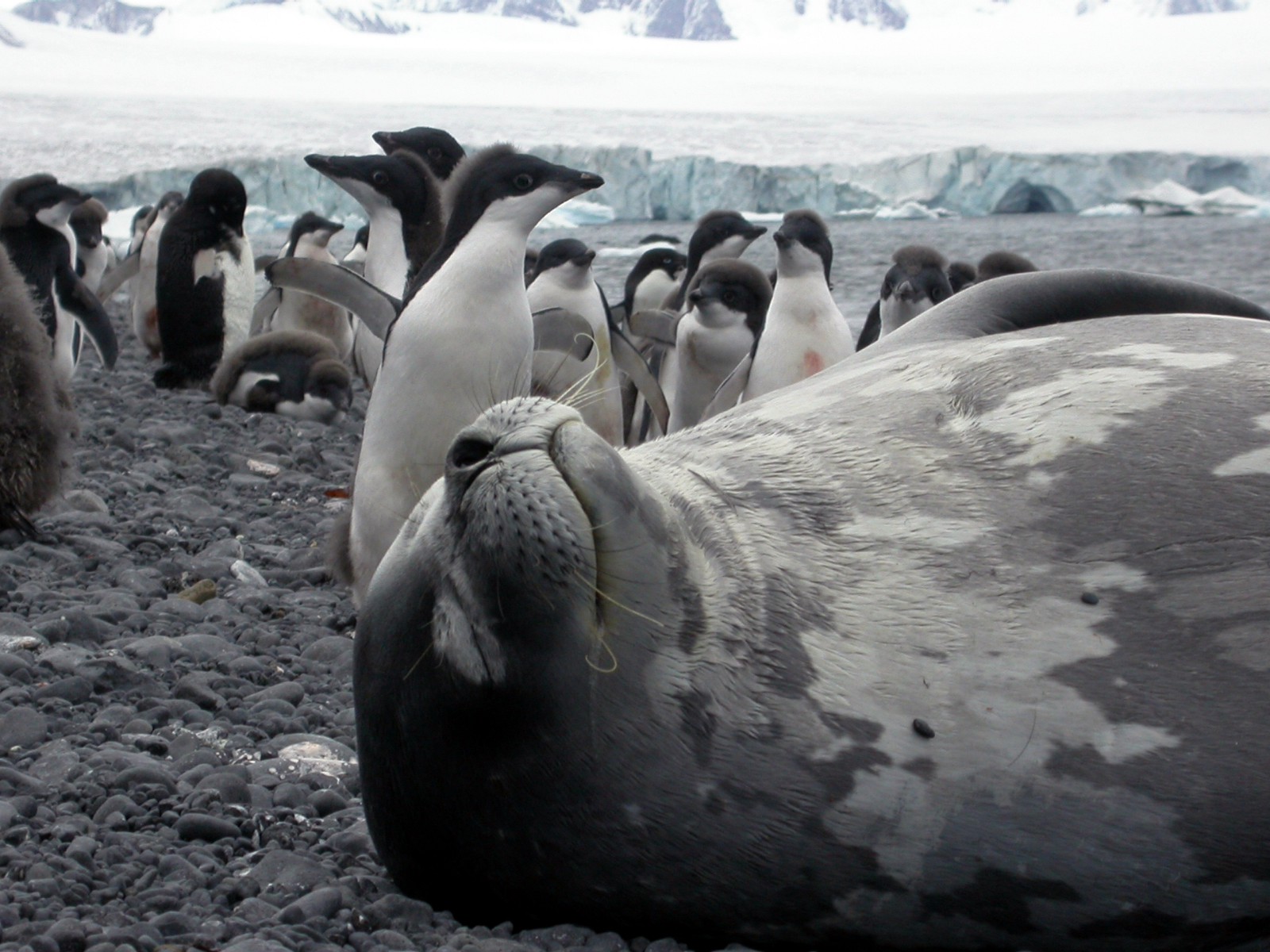
Pingvins and Seals
11 February 2003
Weddell seals have the most southerly distribution of any mammal, with a habitat that extends as far south as McMurdo Sound (at 77°S).
The Weddell seal was discovered and named in the 1820s during expeditions led by James Weddell, the British sealing captain, to the parts of the Southern Ocean now known as the Weddell Sea. However, it is found in relatively uniform densities around the entire Antarctic continent.


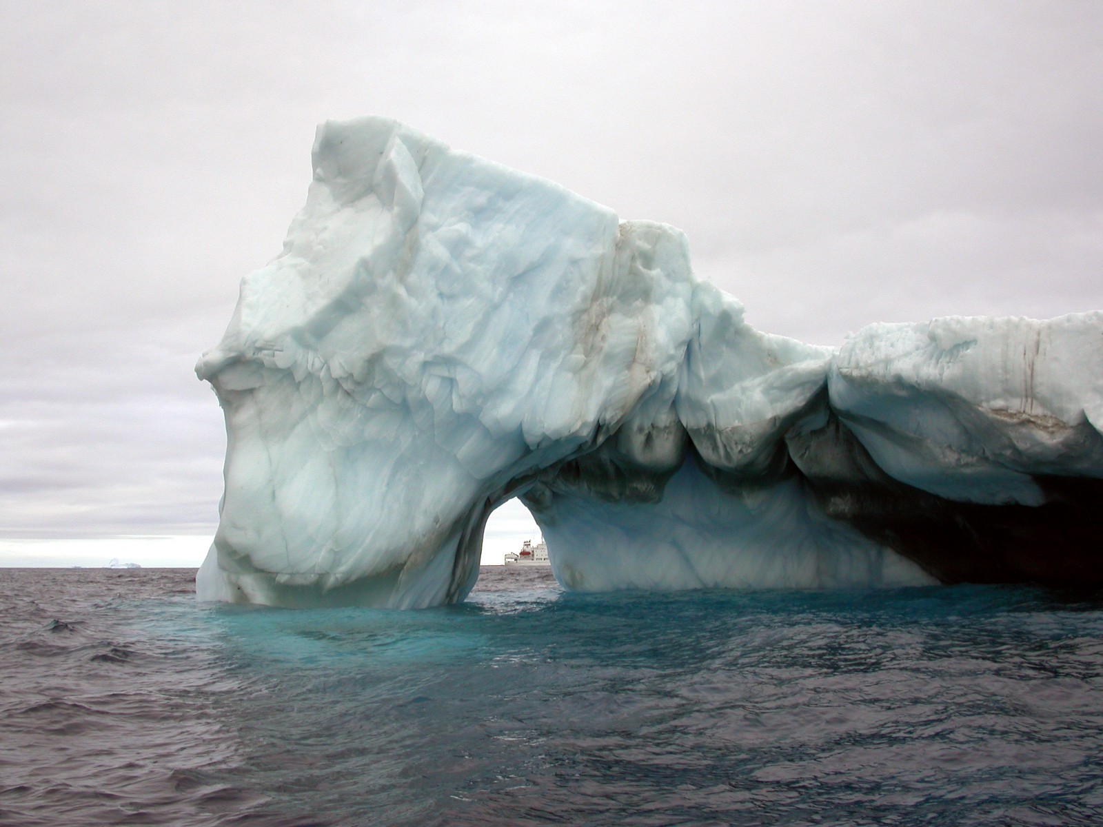
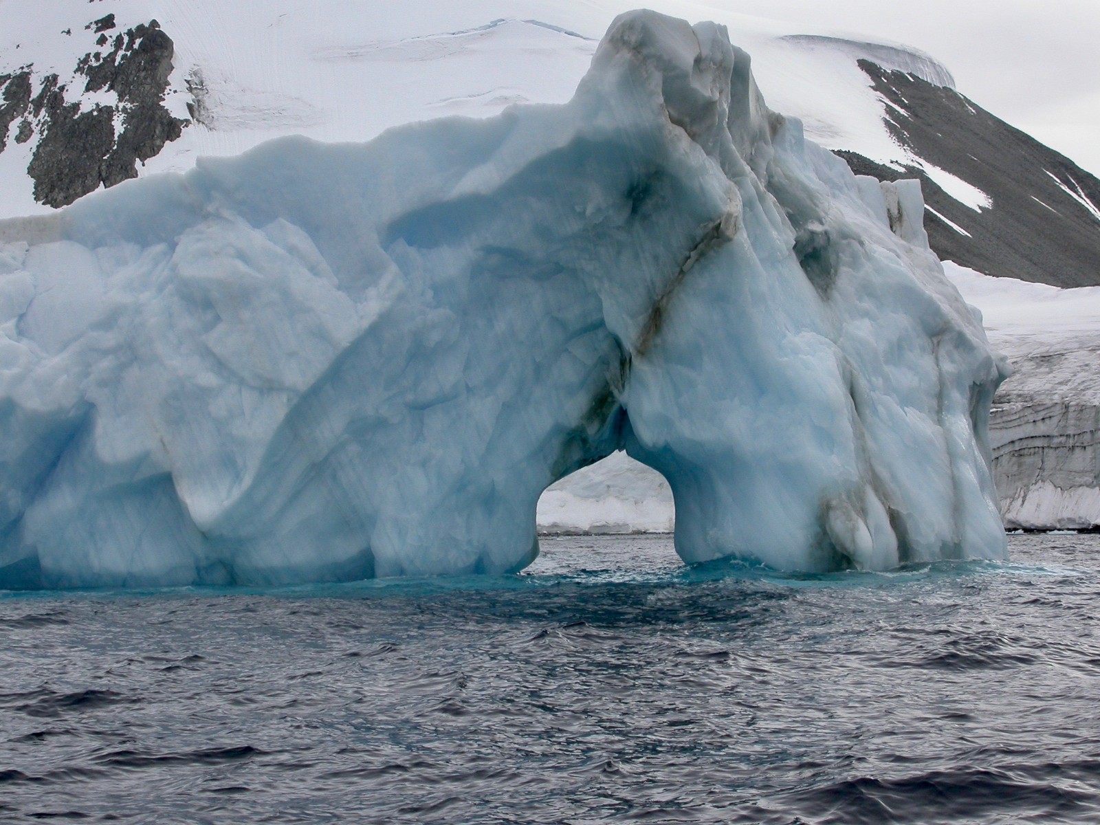
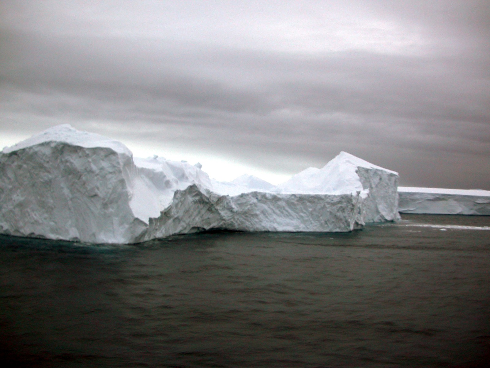
Erebus and Terror Gulf
11 February 2003
Erebus and Terror Gulf is a gulf on the southeast side of the tip of the Antarctic Peninsula, bordered on the northeast by the Joinville Island group and on the southwest by the James Ross Island group. It was named for HMS Erebus and HMS Terror, the vessels used by Sir James Clark Ross in exploring these waters in 1842–43. This region contains tabular icebergs.

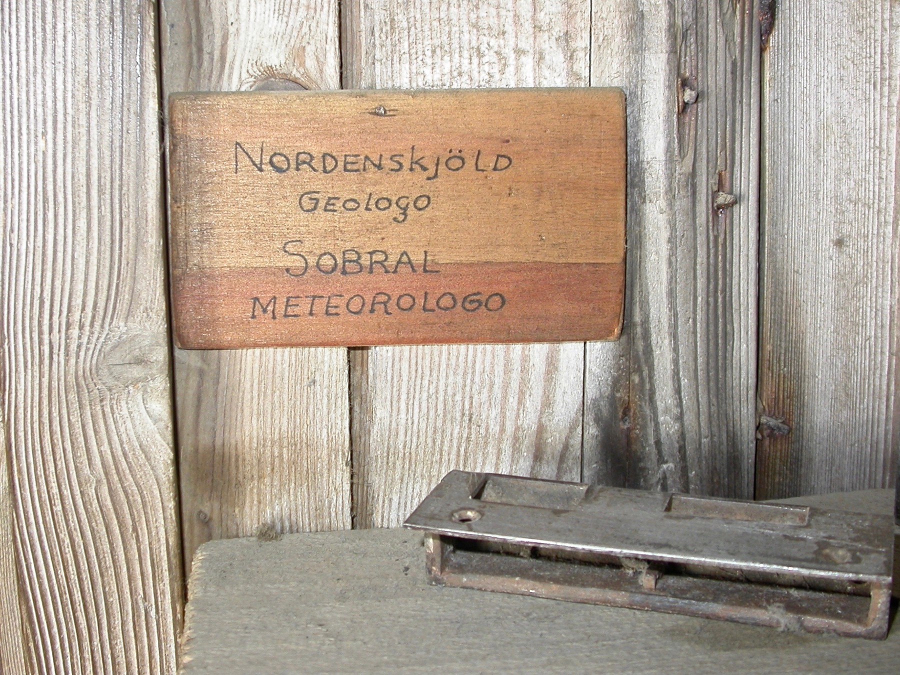
View Point huts at Duse Bay
12 February 2003— Position 63°33’S / 57°22'W
The View Point Huts was in operation by British Antarctic Survey between 1953 and 1963. Was used for Survey, geology and meteorology. Established as a satellite base for Hope Bay (Station D). Transferred to Chile on 29 July 1996 and renamed General Ramon Canas Montalva.


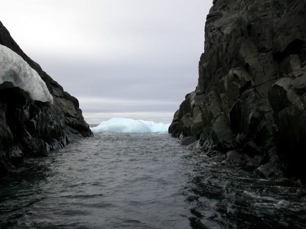
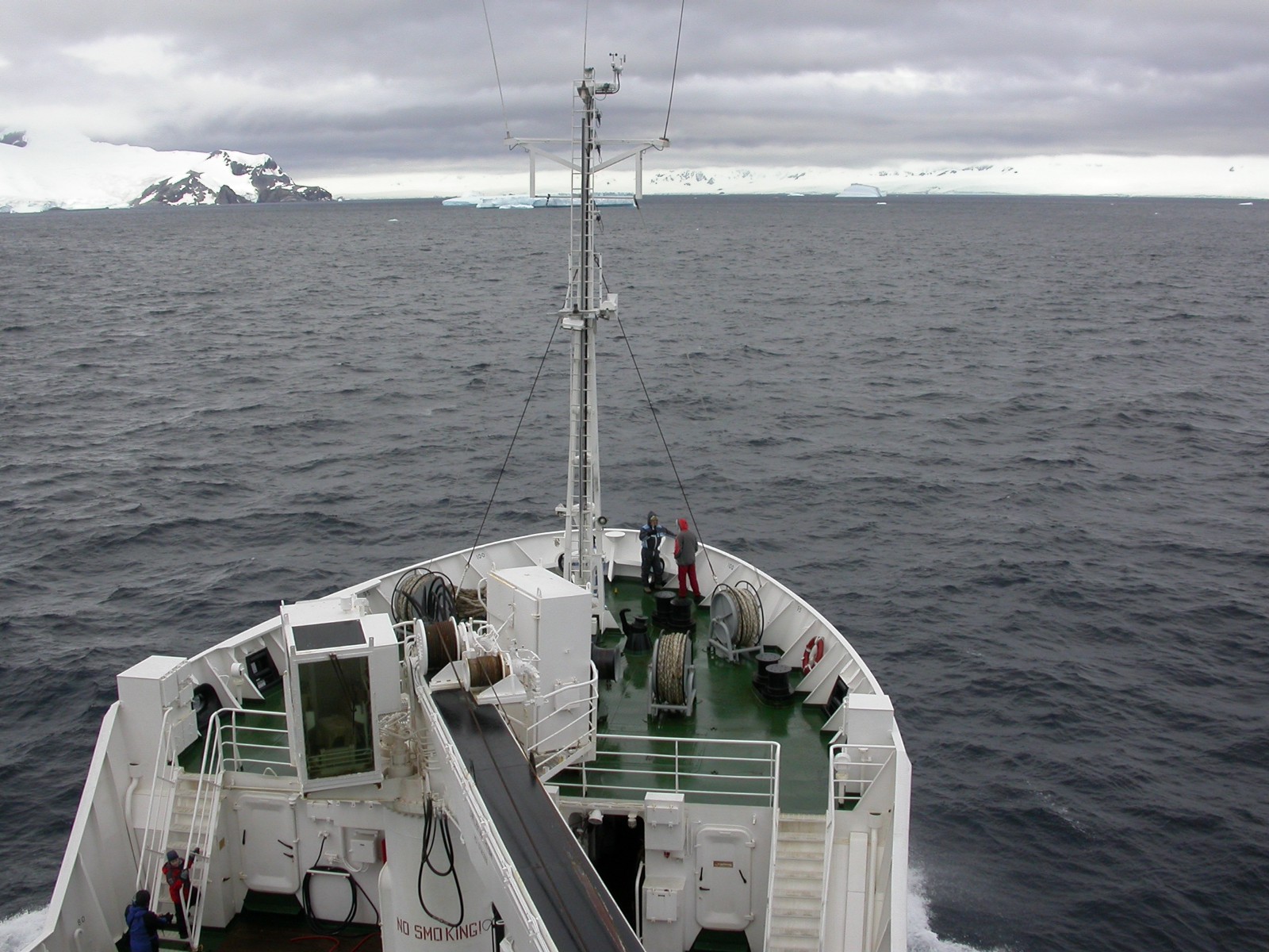
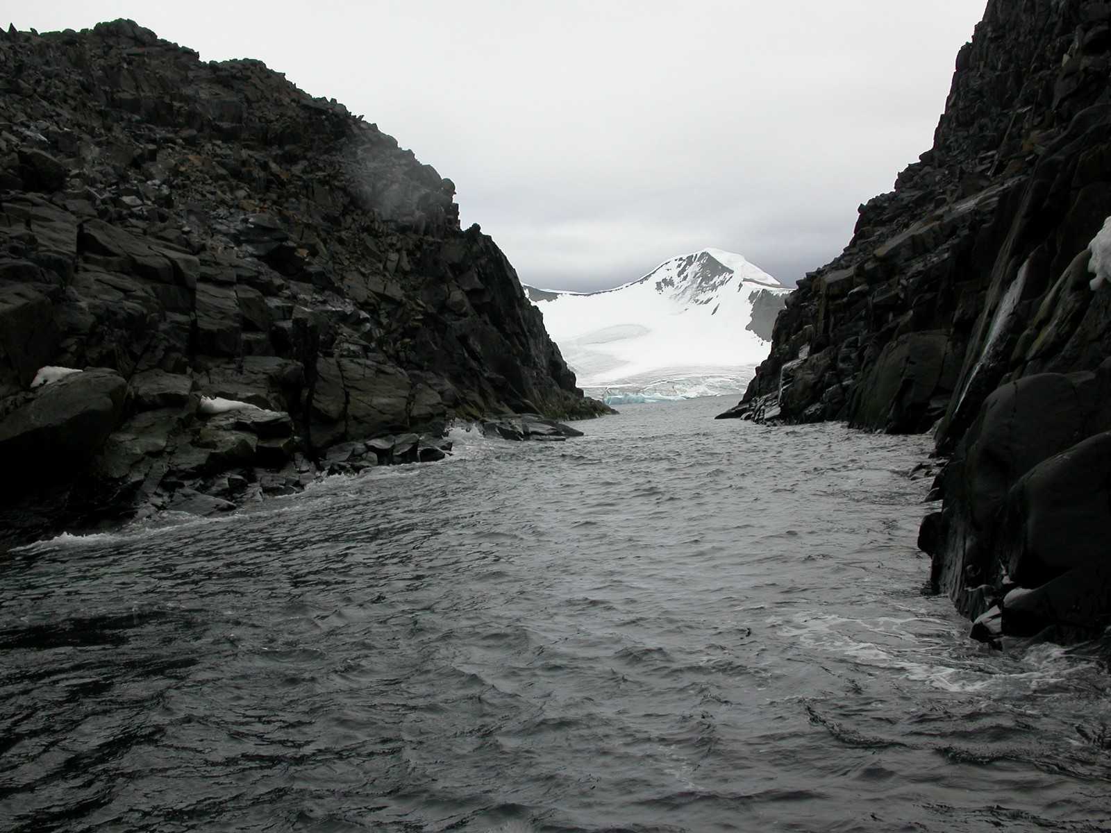
On the way to Paulet Island
12 February 2003


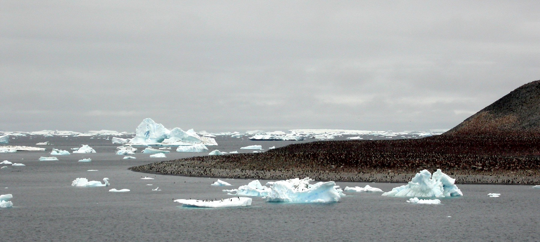


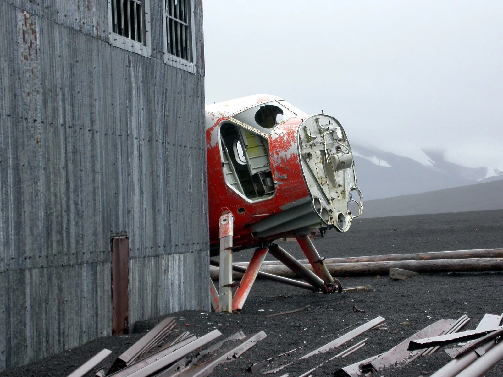
Paulet Island
12 February 2003— Position 63°35’S / 55°47'W
Paulet Island was discovered by a British expedition (1839–1843) under James Clark Ross and named by him for Captain the Right Honorable Lord George Paulet, Royal Navy.

In 1903 during the Swedish Antarctic Expedition led by Otto Nordenskiöld his ship Antarctic was crushed and sunk by the ice off the coast of the island. A stone hut built in February 1903 by shipwreck survivors, together with the grave of an expedition member, and the cairn built on the highest point of the island to draw the attention of rescuers, have been designated a Historic Site or Monument (HSM 41), following a proposal by Argentina and the United Kingdom to the Antarctic Treaty Consultative Meeting. The shipwrecked crew of the Endurance original plan was to travel to the island and use stores there that were left by the above Swedish Expedition but the ice pack that they were stranded on eventually drifted too far east.
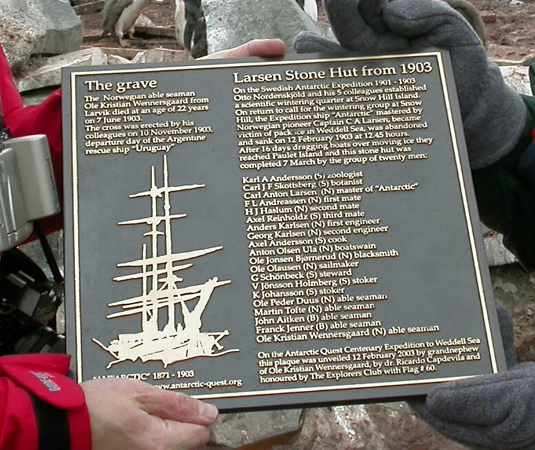
Photo of the plaque at Paulet Island 12th of February 2003 - Photo taken by Teodor Bjerrang


Ruins of Larsen’s Stone Hut, Paulet Island and the grave of Ole Christian Wennersgaard (1881–7. juni 1903)

Kim Baumann Larsen (Grandson of Antarctic pioneer captain C. A. Larsen) and Dr. Ricardo Capdevila (Curator at Direccion National del Antartico in Buenos Aires) unveiling the plaque 12th of February 2003. Photo: Teodor Bjerrang

Signed by the people at the island 12th of February 2003.


Old photos by C. A. Larsen and G. Bodman
Antarctic ceremony
A smal ceremony at the exact coordinates and timeof day as that the ship Antarctic went down 12th February 1903.- Position 64°04’S / 55°25'W — Air -1°C, snowfall, 5–10 cm of snow on the decs, water 1°C, no wind, pressure 1010 mb
The crew of «Antarctic» 1903 (alphabetic):
Axel Andersson (s) cook b. 1876
F L Andreassen (n) 1. mate b. 1859
O Jonsen Bjørnerud (n) blacksmith b. 1868
Ole P Duus (n) able seaman b. 1882
Thoralf Grunden (n) able seaman b. 1874
H J Haslum (n) 2. mate b. 1859
V Jönsson Holmberg (s) stoker b. 1875
K Johansson (s) stoker b. 1879
Ole Jonassen (n) dogsledge driver b.1874
Anders Karlsen (n) 1. engeneer b. 1864
Georg Karlsen (n) 2. engeneer b. 1883
Carl Anton Larsen (n) captain b. 1860
Ole Martin Olaussen (n) carpenter b. 1874
Anton Olsen Ula (n) boatswain b. 1861
Axel Reinholdz (s) 3. mate b. 1873
G Schönbeck (s) steward b. 1879
Martin Tofte (n) able seaman b. 1852
H Åkerlund (s) cook b. 1870
Signed off in Buenos Aires:
John Aitken (falklender) able seeman b. 1880
Franck Jenner (british) able seaman b. 1880
Died at Paulet Island 7. June 1903:
Ole K Wennersgaard (n) able seaman b. 1881


Elephant Island
13 February 2003 — Position 61°17’S / 55°13'W (Point Lookout), 61°06’S / 54°52'W (Point Wild) — Air 1°C, Water 1°C, Wind 2 Beaufort, light breeze, and swell, pressure 1010 mb
Elephant Island is an ice-covered mountainous island off the coast of Antarctica in the outer reaches of the South Shetland Islands, in the Southern Ocean. Its name was given by early explorers sighting elephant seals on its shores.
The island supports no significant flora or native fauna although migratory gentoo penguins and seals may be found, and chinstrap penguins nest in season. A lack of safe anchorage has prevented any permanent human settlement, despite the island being well placed to support scientific, fishing and whaling activities. Elephant Island’s name can be attributed to both its elephant head-like appearance and the sighting of elephant seals by Captain George Powell in 1821, one of the earliest sightings.
The weather is normally foggy with much snow, and winds can reach 160 km/h (100 mph).

The island is most famous as the desolate refuge of British explorer Ernest Shackleton and his crew in 1916. Following the loss of their ship Endurance in Weddell Sea ice, the 28 exhausted men reached Cape Valentine on Elephant Island after a harrowing ordeal on drifting ice floes. The first of Shackleton’s crew to set foot here, and presumably the first person ever to make landfall, was Perce Blackborow, originally a stowaway on Endurance. Since Blackborow was the youngest crew member, Shackleton commanded that he make the first landfall on the island. After camping at Cape Valentine for two nights, Shackleton and his crew moved 11 kilometres (7 mi) westwards to a location which offered better protection from rockfalls and from the sea, and which they called Point Wild.


Back to Ushaia via the Drake Passage
14-15 February 2003 — Position 59°30’S / 58°02'W (14th 7.30 a.m.360 nm from Cape Horn) — Air 4°C, water 2°C, wind 6 Beaufort E, strong breeze, swell, pressure 1022 mb

Leaving Elephant Island on our way via Drake Passage to Ushuaia
Total length of the trip: 1857 nm / 3439 km / 2137 statute miles
The Explorers Club
The trip was an official “The Explorers Club” Flag Expedition. (Flag# 60 — Antarctic Quest Expedition) (2003 FLAG# 60)

The Explorers Club is an international multidisciplinary professional society dedicated to the advancement of field research and the ideal that it is vital to preserve the instinct to explore. Since its inception in 1904, the Club has served as a meeting point and unifying force for explorers and scientists worldwide. Their headquarters is located at 46 East 70th Street in New York City.